top

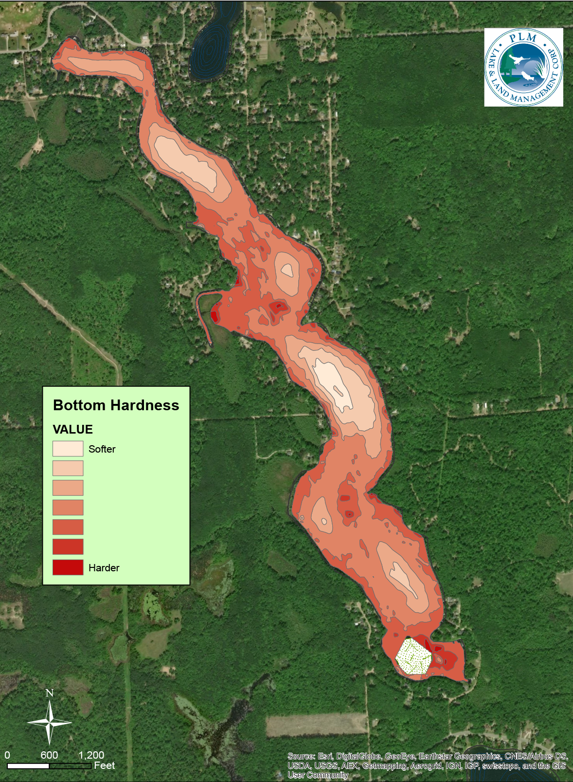
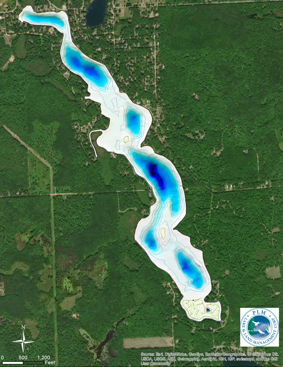
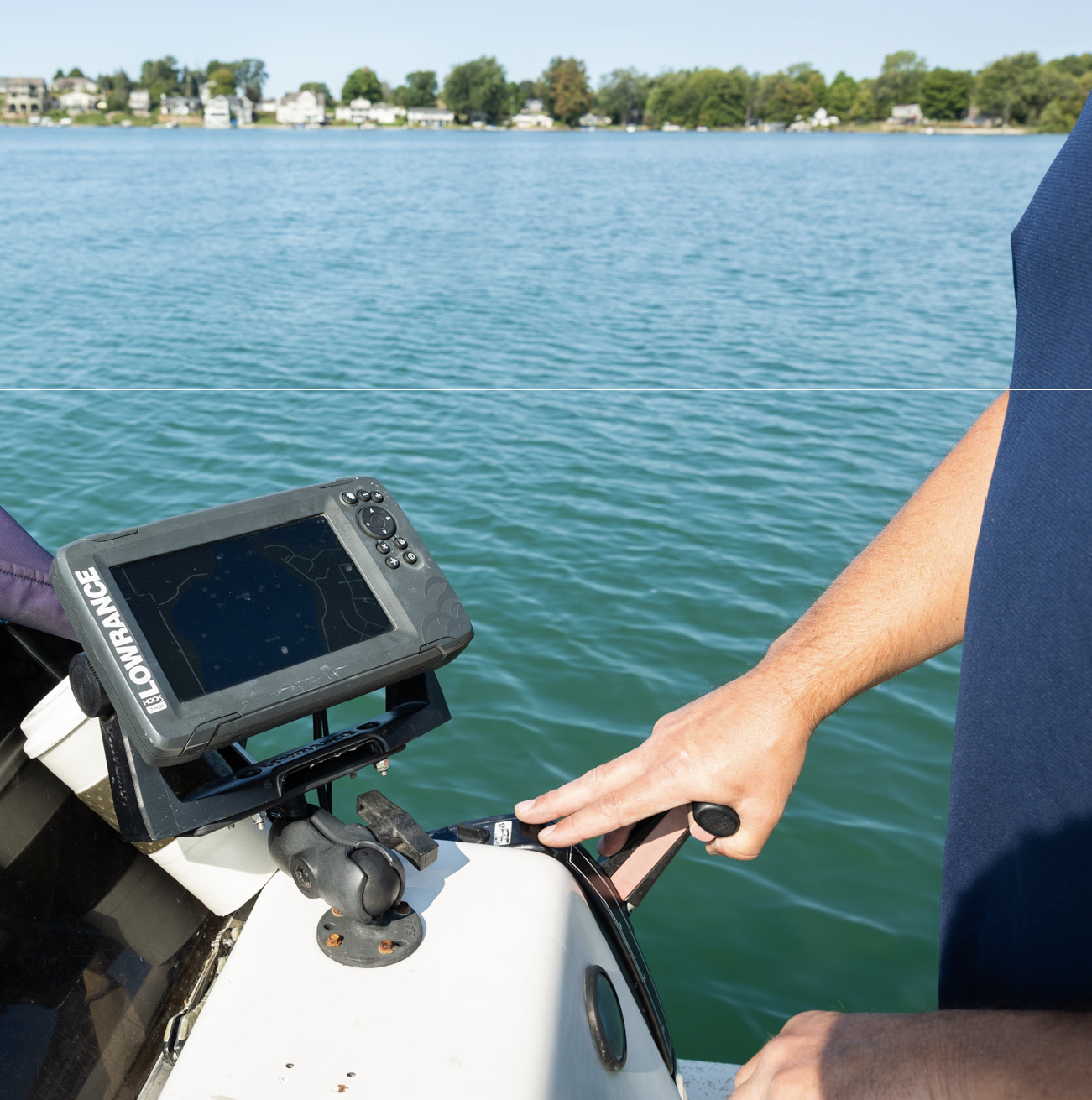
Lake Depth and Volume Mapping

Knowing the true depth and volume of your lake or pond is critical for effective aquatic management. PLM’s lake depth and volume mapping services provide precise measurements that support everything from vegetation control and aeration design to herbicide application planning and long-term lake management.
Two men on a boat with lake and trees in the background, one steering and the other handling equipment.
Aerial map showing bottom hardness of a long, narrow pond or lake surrounded by forest and scattered homes, with color-coded contour areas from softer (light peach) to harder (dark red) bottom.
Topographic map of a lake with depth contours shown in shades of blue surrounded by dense green forest and scattered buildings.

Lake & Pond Bathymetric Mapping Services

PLM offers professional lake depth mapping, pond depth surveys, and waterbody volume calculations using advanced survey equipment and proven mapping techniques. These bathymetric surveys create detailed depth contours and accurate volume estimates that help eliminate guesswork from lake and pond management decisions.
Lake depth and volume mapping is often essential for determining correct treatment rates, designing aeration systems, evaluating sediment accumulation, and supporting permit applications. By understanding how deep your lake or pond truly is, and how water volume varies across the basin, you gain a reliable foundation for safer, more effective, and more cost-efficient aquatic management.

Lake Depth & Volume Mapping Process

1. Project Review & Site Planning

We review the size, access points, and management goals of your lake or pond to determine the most appropriate depth mapping approach.

2. On-Water Depth Survey

PLM conducts a detailed lake or pond depth survey, collecting depth data across the entire waterbody using GPS-enabled equipment.

3. Data Processing & Mapping

Collected data is processed to create accurate bathymetric maps showing depth contours and basin features.

4. Volume Calculation & Analysis

We calculate total water volume and depth distribution, providing critical data for lake management planning and treatment applications.

5. Reporting & Management Support

You receive clear maps and summaries that can be used for aquatic vegetation management, algae control, aeration planning, and long-term lake or pond management decisions.

Markets We Serve

PLM provides lake depth & volume mapping services for a wide range of public and private clients, including:
Watershed Districts
Lake Improvement Boards
Federal, State, and Local Municipalities
Lake Associations
Golf Courses
Private Lake and Pond Owners
Property Management Companies
No matter the size or complexity of the waterbody, PLM delivers consistent, professional services you can trust.
Person standing on a small motorboat in calm water with a hazy shoreline and houses in the background.

Industry-Certified Specialists

Backed by trained specialists and certified applicators who meet strict regulatory and safety standards.

Environmental Organization Members

Engaged with APMS, MAPMS, MLSA, NALMS, AERF, and other industry groups. Learn more about our memberships and certifications here.

State-Licensed Professionals

Proud members of RISE, the Better Business Bureau, and the Grand Rapids Chamber of Commerce.
Person operating boat throttle next to a mounted Lowrance fish finder screen on a lake.Man wearing white protective Tyvek suit, blue gloves, and a hat with earmuffs, sitting on an airboat near water with trees and houses in the background.
Three men on a blue airboat on a lake surrounded by forest, two men in white protective suits and one holding a yellow paddle.Woman wearing sunglasses and a PLM shirt steering a boat on a lake with green trees in the background.Man operating a blue and white aquatic weed harvester on a lake surrounded by trees.

Ready to get started?

Speak with a PLM aquatic specialist to take the first step toward effective, long-term aquatic management.
Contact Us

Search for something